
Today, I am posting information on the Loch Tay area in Perthshire, central Scotland.
Summary Information
This loch (lake) lies at an approximately 45 degree angle with the village of Killin at south and Kenmore, near Aberfeldy at northern end. Kenmore is about seventy-seven miles north of Glasgow.

The loch is about 14.5 miles long and 1.5 miles at widest.

More information on the Loch Tay Region
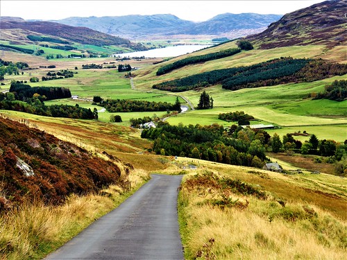
This region is relatively quiet, providing many opportunities for activities and relaxation including hiking, boating, golf, fishing, photography, white water sports (Grandtully) and climbing local mountains. There is also an excellent ‘backroads’ drive between Kenmore and Amulree known as ‘Glen Quaich‘, however this road is usually closed during winter.

Accommodation is available at both ends of the loch, at Killin and Kenmore
Here is a summary of information concerning the loch (lake) and environs:
- Has been occupied by man since prehistoric times. On the hills to the east is Greenland Stone Circle whilst a little further north is Croft Moraig Stone Circle.

Prehistoric rock carvings on western bank of the loch, possibly 5000 years old.

- During the Iron-Age (about 2500 years ago) the loch, in common with many other lochs and lakes, was populated by dwellings known as crannogs. A crannog has been reconstructed near Kenmore and is now a visitor attraction.

- Near Kenmore can be found the Falls of Acharn and Taymouth Castle. (Latter is not a visitor attraction.)


More information on Loch Tay and sightseeing in Scotland can be found in Visitors’ Guide to Scotland, ISBN 978-1-9161332-0-4