Introduction
Tonight, I am posting images and video clips taken during a train journey from Glasgow to Fort William. This encompassed Rannoch Moor and other sites as described below.

Infdormation on the trip
 The section of the journey covered Dalmally via Tyndrum, Bridge of Orchy, Rannoch Station, Spean Bridge ending in Fort William.

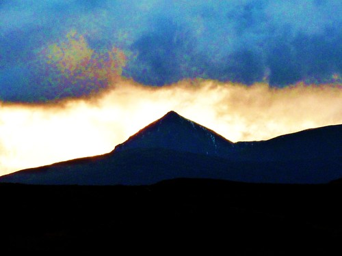
Weather conditions were unusually favourable for the time of year. The relatively clear and sunny conditions showing the rugged scenery including moorland, rivers,, snow-capped mountains and lochs to best advantage.

Rannoch Moor is a 50 square mile plateau at height of 1200 ft (360 metres). It is bounded by Loch Rannoch, Lochaber and Argyll & Bute and rim of mountains between 2500 ft and 3500 ft. Terrain is mainly granite. The surface shows the effects of glacial movements resulting in small lakes and rocky knolls of glacial debris. This plateau is where the last ice sheet began to develop about 25,000 years ago and where is finally extinguished about 10,000 years ago.


First Video Clip
Video Clip 2
Video Clip 3
Final Video Clip
Most visitors encounter Rannoch Moor when travelling along the A82 to Glencoe with spectacular landforms visible between the Pass of Brander and Loch Lochy.
More information.
Information on the Highlands and many other aspects of Scotland can be found in the Visitors’ Guide to Scotland. This publication is also available via Kindle. ISBN is 978-1-9161332-0-4.