Introduction
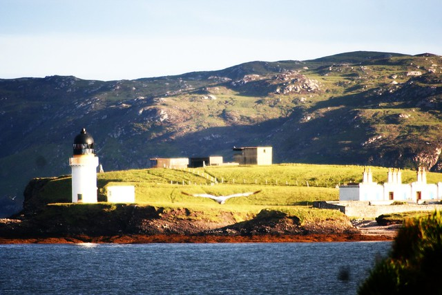
This evening, I am providing information on the principal visitor sites on the Isle of Lewis (Eilean Leodhais). This island forms part of a chain off Scotland’s N.W. coast known as the Outer Hebrides.

Callanish Prehistoric Stone Circle
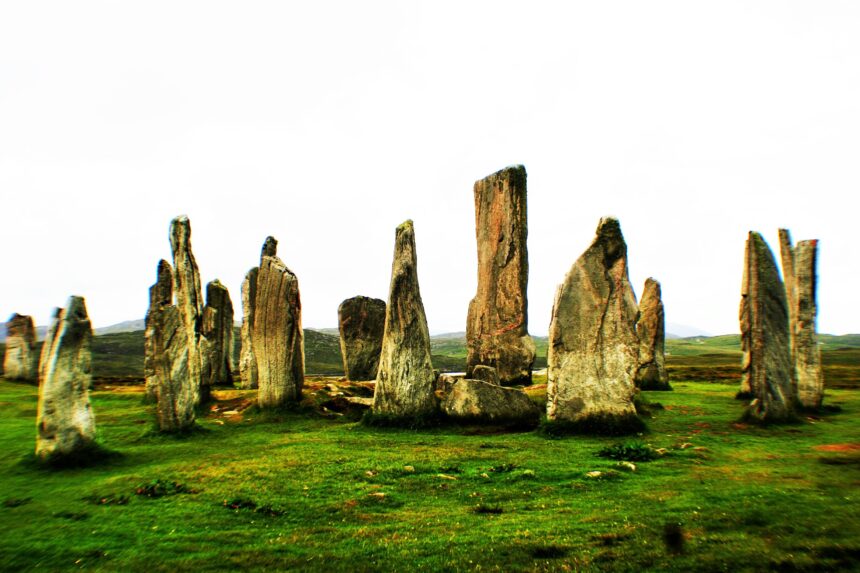

This stunning site is located some 13 miles west of Stornoway (capital of Lewis). Some key aspects:
- Was probably built over several phases, not as a single project.
- The circle is actually an ellipse.
- This is just one of a concentration of stone circles in this particular locality. Similar concentrations can be found in other parts of Scotland such as Kilmartin Glen in Argyll.
- Comprises a diminutive stone circle, a central stone, an avenue, three rows and a chambered tomb.
- Although the site impresses for its grandeur and astronomy the ring is of modest proportions. The internal area is just 1334 sq ft or 124 sq m.
- The central line of the stone avenue is aligned on the setting of the southern moon.
- The site may date from 2200 BC.
- Was covered in peat and the scale of the site only became evident in 1857. Interestingly, stone circle building ceased around 1000 BC, a time which coincided with climate change. This in turn triggered an accretion of peat which in turn protected the site over a period of some 3000 years.
Video clip
Carloway Broch


- An example of a distinctive form of settlement, unique to Scotland. This site probably dates from around the early first millennium, possibly a little earlier.
- Brochs are found on Orkney, Shetland, the Western Isles (including Lewis) and the Highland region of the Scottish mainland.
- Brochs are dry stone towers extending to a height of about 33 feet and about 82 feet in diameter. Walls are thick at the base tapering towards the top. The walls usually feature a double skin which allows stairs and walls between the walls. This feature also provides insulation benefits.
- It is probable that inside the broch were wooden floors at different levels.
- There may have been a central fireplace but the roof would have been enclosed (with thatch).
- The Carloway broch, like many others, is situated close to the sea thus suggesting marine activities (and fishing) were important. Pastoral farming was also probably undertaken.
- A broch would likely be the home of a high status and/or powerful personage together with extended family and animals.
- Carloway Broch is open to the public and is just a short drive from Callanish Stones.
Video clip
Gearrannan Blackhouse Village

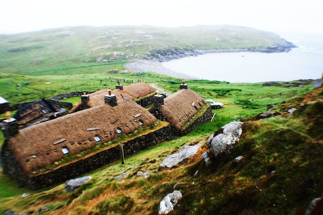
Gearrannan Blackhouse Village, Lewis, Hebrides
- A restored traditional village reflecting life on Lewis until the 1950s.
Norse Mill & Kiln

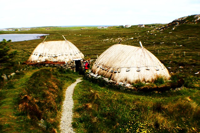
Norse Mill & Kiln, Lewis, Outer Hebrides
- Although labelled ‘Norse’ this type of mill was in use until the 1930s, possibly over a period of 2000 years. The Norwegians (Vikings) were in control for a relatively short period, from the 9th to 13th centuries.
- In essence this type of mill is a very cheap and ‘eco-friendly’ means of converting grain ( mainly barley) into flour. Power was provided via a mill race (diverted stream) which emanated from nearby Loch Roinavat.
- Grain was delivered to the mill and then kiln dried to the required moisture level.Next stage was transfer to the adjacent mill for grinding into flour.
- This mill was certainly not unique, but typical of hundreds of such historic milling operations on the islands.
- This site is located near Shawbost off the A858 and entails a walk of about one-third of a mile. It is open 24/7.
Video clip
Dun Eistean

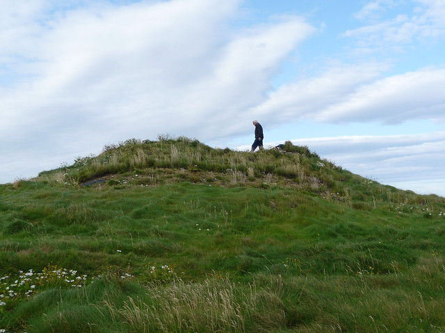
Dun Eistean, Lewis, Outer Hebrides.
- This site is of historic significance. Glasgow University undertook a prolonged archaeological investigation over the period 2000-2004.
- Location is at the north of the island, close to the Butt of Lewis. The site can be accessed by car but this entails navigating a rough farm track over a distance of about 1 mile.
- Upon arrival the visitor will not be presented with the usual stone ruins and the like but a mound on a small islet. Access is via a footbridge over a ravine which in its day would have formed a natural, defensive moat. It is believed that, up until late medieval times, this was the power base of the Morrisons. This clan’s authority may have derived from the Lords of the Isles but collapsed when the Lordship came to an end in the late 15th century.
Aerial photographs of the apparently innocuous mound reveal the outlines of buildings. An archaeological investigation by Glasgow University 2000-2004 revealed a complex site comprising:
- A rectangular dwelling with central hearths.
- A Gatehouse and storage buildings or shelters.
- A triangular enclosure which defended the west of the island (facing the sea).
- Corn-drying kilns and a barn used for storing and drying barley.
- A settlement area with a central living space together with turf and stone buildings.
- Pond to collect fresh water.
- A rectangular tower or keep which once may have been 4 metres (12 feet) high.
- A defensive perimeter wall of turf with stone facing.
The small island is now owned by Clan Morrison Society.
Butt of Lewis


Butt of Lewis, Outer Hebrides, Scotland
This is the northern tip of the Isle of Lewis where can be found:
- A David Stevenson designed lighthouse dating from the 1860s. This is constructed of red brick and was automated in 1998.
- Very ancient rocks known as Lewisian Gneiss which are aged between 2.6bn and 1.6bn years.
- Port Stoth, a pretty cove with sandy beach.
- Some 370 species of birds
- Strong winds and sheer cliffs.
Video clip
https://www.youtube.com/watch?v=EZ8gr_9DAGU
More information for the visitor
For more information on Scottish islands refer Visitors Guide to Scotland, ISBN 978-1-9161332-0-4. This book is also available via Kindle.